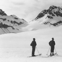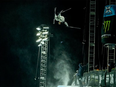
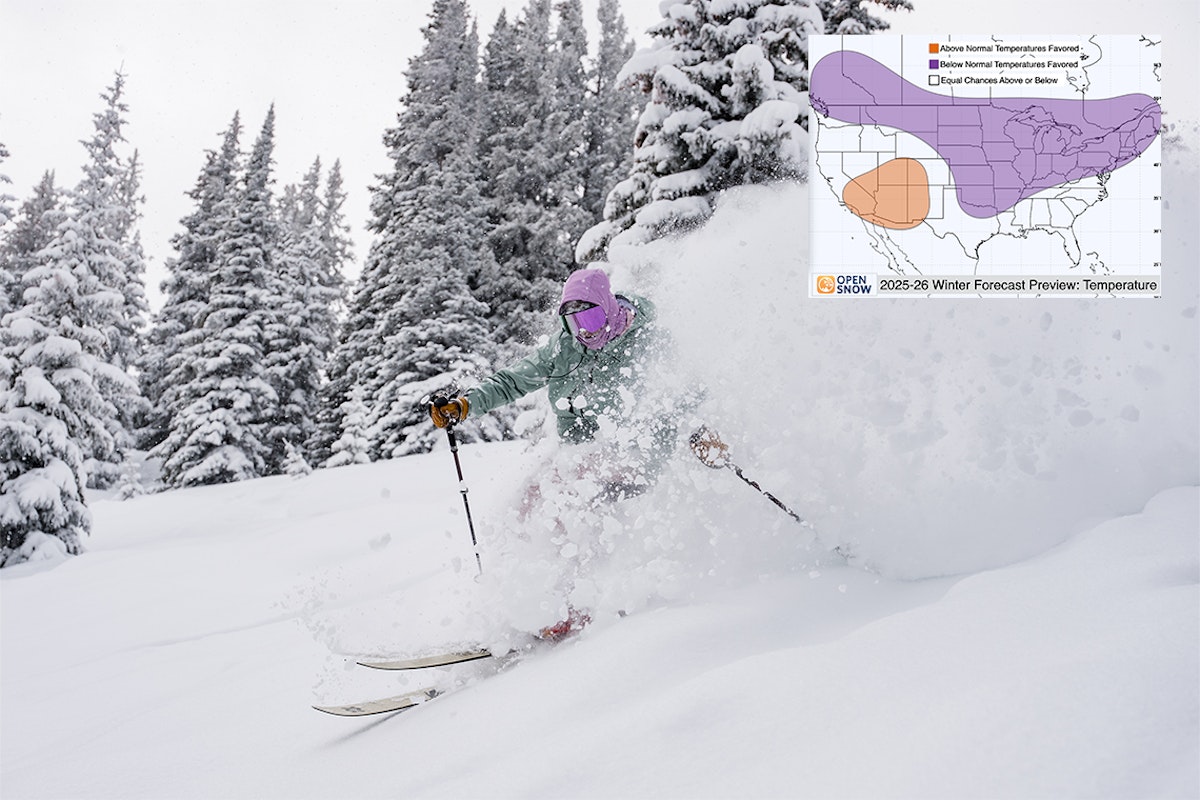
Featured Image: Gabe Rovick | Skier: Colter Hinchliffe
Forecast as of: September 2025
Our friends at OpenSnow have brought ski season that much closer with the release of their long-range predictions for the upcoming winter. With analysis from professional meteorologists Luke Stone and Alan Smith, as well as data from NOAA, this comprehensive assessment takes into account years with similar trends to give us an idea of where the snow is likely to fly.
Smith bases his latest predictions on several factors, most notably the ENSO Cycle and the Atlantic Quadpole Mode (AQM). FREESKIER explores what these terms and factors mean, how they impact snowfall projections and which parts of North America can expect the most pow this winter.
We’ve included the full video from OpenSnow below, as well as a few key takeaways and important points if you’re running short on time and just want to jump to the point.
It’s good to understand the specific terms before proceeding. NOAA states that, “El Niño and La Niña represent opposite extremes in the El Niño/Southern Oscillation (ENSO). The ENSO cycle refers to the coherent and sometimes very strong year-to-year variations in sea-surface temperatures, rainfall, surface air pressure, and atmospheric circulation that occur across the equatorial Pacific Ocean.”
Temperature averages are recorded in three-month overlapping periods. When five consecutive periods reach warmer (+0.5°C) or colder (-0.5°C) temperatures compared to the average, they are dubbed El Niño and La Niña, respectively. If temperatures do not stray that far from the average, the cycle is called ENSO Neutral.
Editor's Note: 0.5°C = apprx. 32.9°F
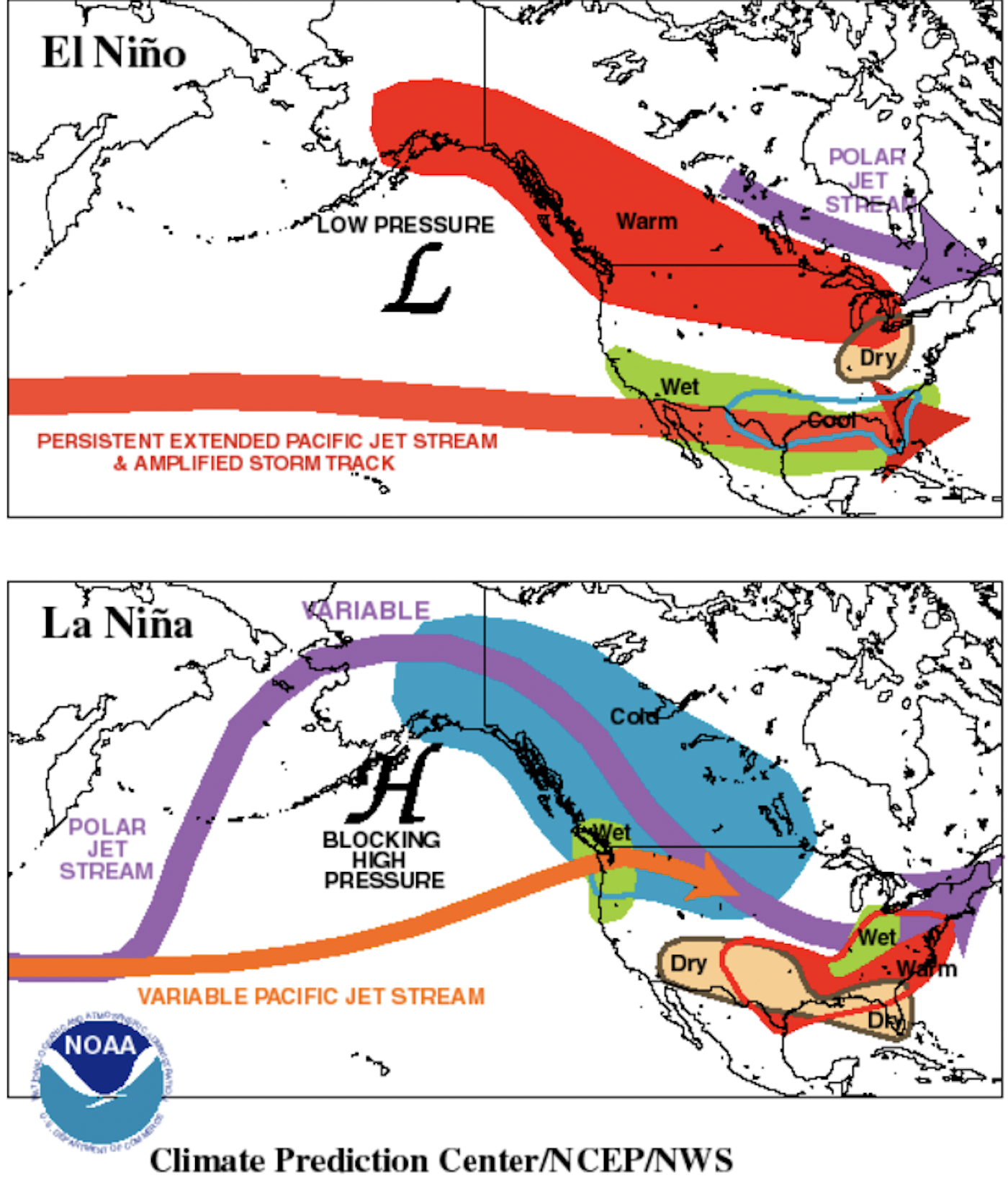

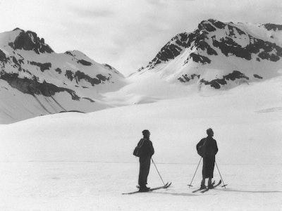
El Niño (top visual) is characterized by warmer than normal tropical Pacific ocean surface temperatures.
Typically lasts around 9-12 months and is more frequent, according to NOAA.
La Niña (bottom visual) is characterized by cooler than normal tropical Pacific ocean surface temperatures.
Typically lasts 1-3 years. According to NOAA, durations of either can vary greatly, even by a matter of years.
ENSO Neutral to Weak La Niña Favored
While there was a lot of talk about La Niña last winter, we never saw the pattern truly materialize, with average temperatures staying between + - 0.5°C. So if you thought we were swinging away from La Niña, think again.
NOAA's recent data gives a 56% chance of La Niña emerging by October 2025, reverting back to ENSO Neutral by mid-winter. To better predict temperatures and precipitation, Smith and the OpenSnow team combed through data going back prior to 1990, looking for similar outlooks.

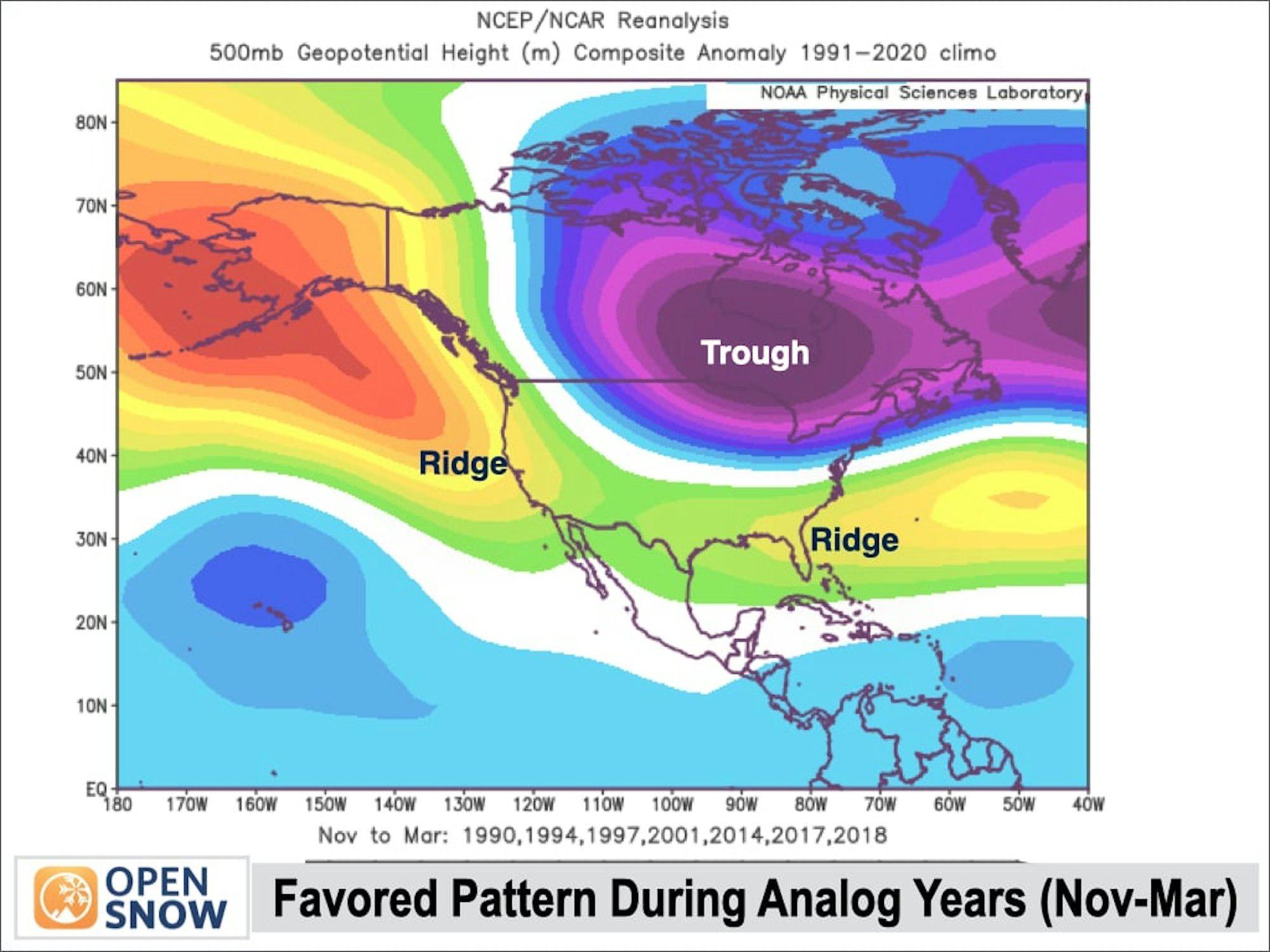
After finding seven comparable analog years (89-'90, '93-'94, '96-'97, '00-'01, '13-'14, '16-'17, '17-'18,) whose summer and fall conditions matched ours, the team derived the following maps illustrating expected temperature and snowfall in an ENSO Nuteral, borderline La Niña winter.

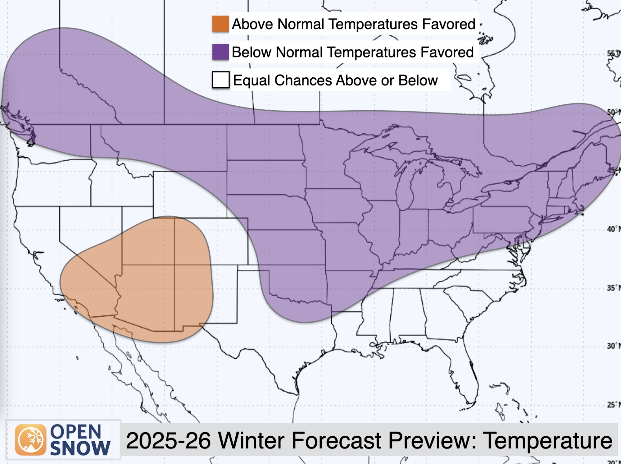
Temperature: As seen above, the team is calling for below-average temperatures this winter in western Canada, the northern U.S. Rockies, the Midwest and the Northeast. In contrast, above-average temperatures are expected for parts of California, Nevada, Utah and Arizona, as well as western Colorado and New Mexico.

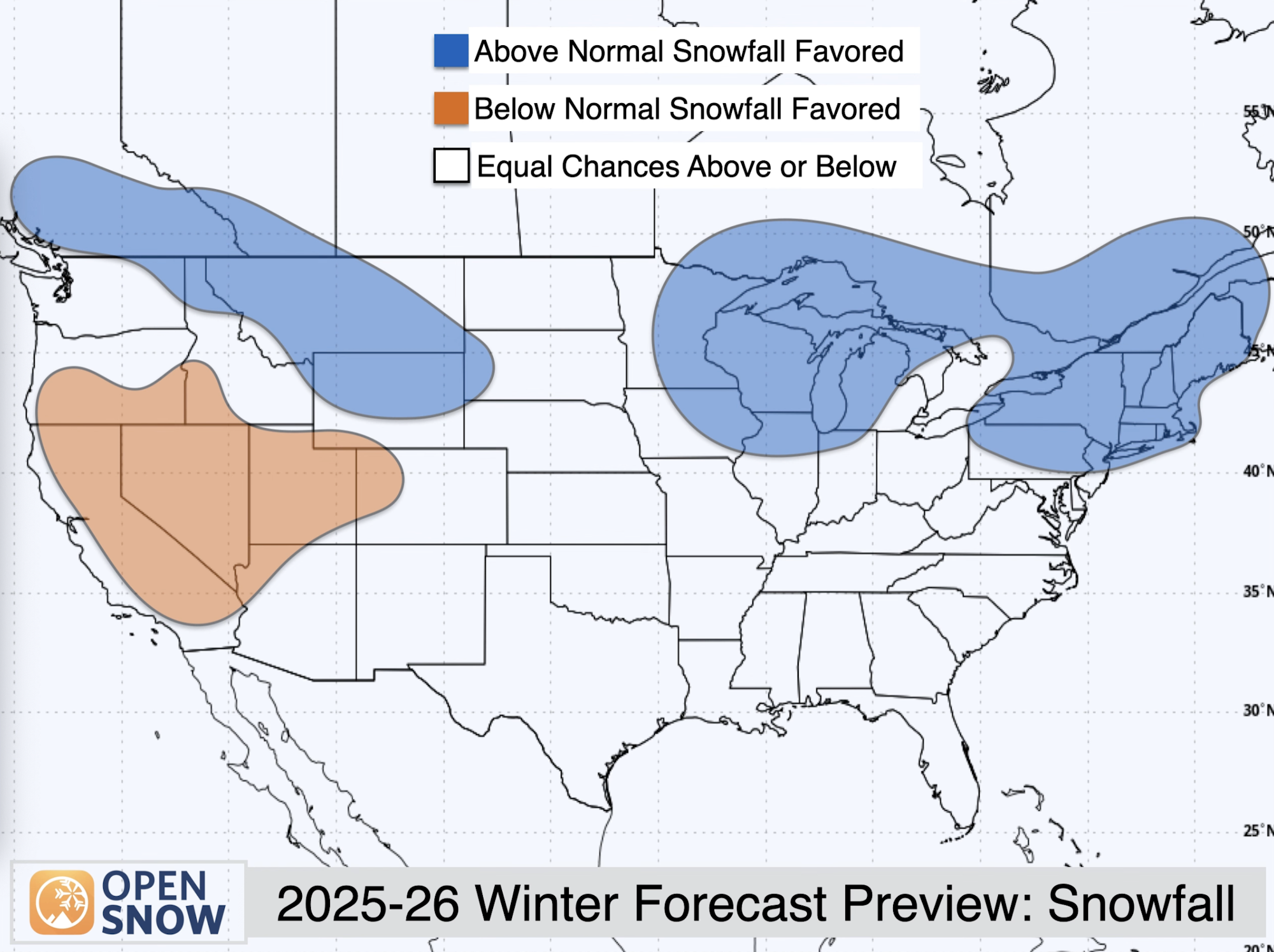
Snowfall: Above-average snowfall is expected for western Canada, the northern U.S. Rockies, the Great Lakes region and much of the Northeast. Key areas that may find themselves engulfed in powder include British Columbia, Montana, northern Wyoming, Michigan and New England.
Similarly to the above average temperature ranges seen above, the below average temperature range hovers around California (though stretching farther north than the temperature bubble), Nevada, Utah, as well as western Arizona and Colorado.
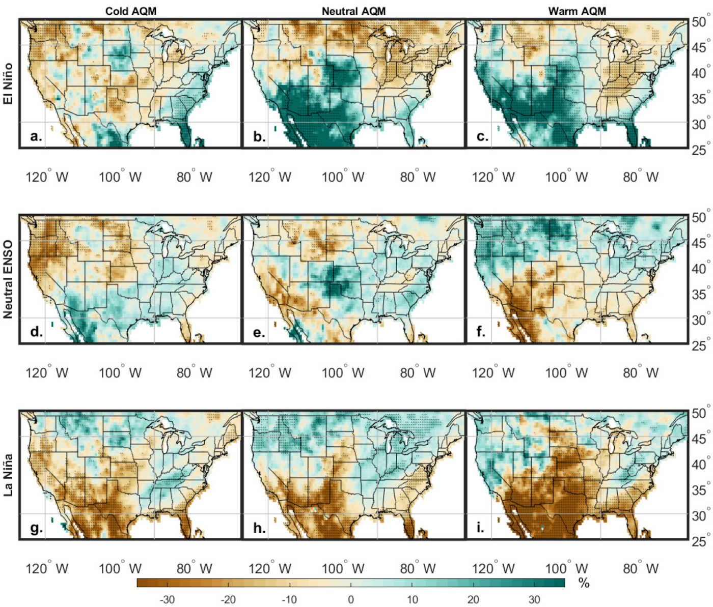
Atlantic Quadpole Model
Another factor Smith discusses in his forecast is the Atlantic Quadpole Model (AQM). Researched by OpenSnow meteorologist Luke Stone during his graduate degree at the University of Utah, the AQM tracks ocean temperatures in the North Atlantic Ocean, similarly to the ENSO cycle in the Pacific.
The AQM has been warmer than average for several years, but current trends show it is clearly cooling in recent months, with a cold phase strongly anticipated to continue into winter 2025/26.
Stone researched how the AQM can alter snowfall in La Niña or El Niño winters. A cold AQM during an ENSO Neutral or weak La Niña winter results in increased precipitation for the northern U.S. Rockies as well as the Southeast, a region that usually receives minimal precipitation during La Niña cycles.

Winners and Losers
It's still too early to rule out any resort as destined for a 'bad year'. As Smith says several times in his predictions, seasonal forecasts like these are far less accurate than short and medium-range predictions. However, there are a few clues illustrated here that are good to observe as you plan your big ski missions for this year.
When considering the data from NOAA, the patterns observed in previous similar years, and the AQM correlations, it appears that the northern U.S. Rockies, the Great Lakes and the Northeast are both due for cold temperatures and high levels of precipitation. Those areas show the greatest overlap on each of the aforementioned maps.
It seems like the Southwest, Nevada and California could be due for a subpar winter, with a few feast or famine storms always possible. Things also don't look great for Utah and Colorado. Though the Wasatch can always count on lake effect storms and Colorado sits more in the middle ground than its neighboring western states.
At the moment, our wild card pick is the Pacific Northwest. The PNW has a lot of mixed factors, with ridge-dominant patterns being expected, while higher precipitation levels are also indicated.
Stay tuned for more updates as we continue the count down until we're back on snow!