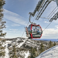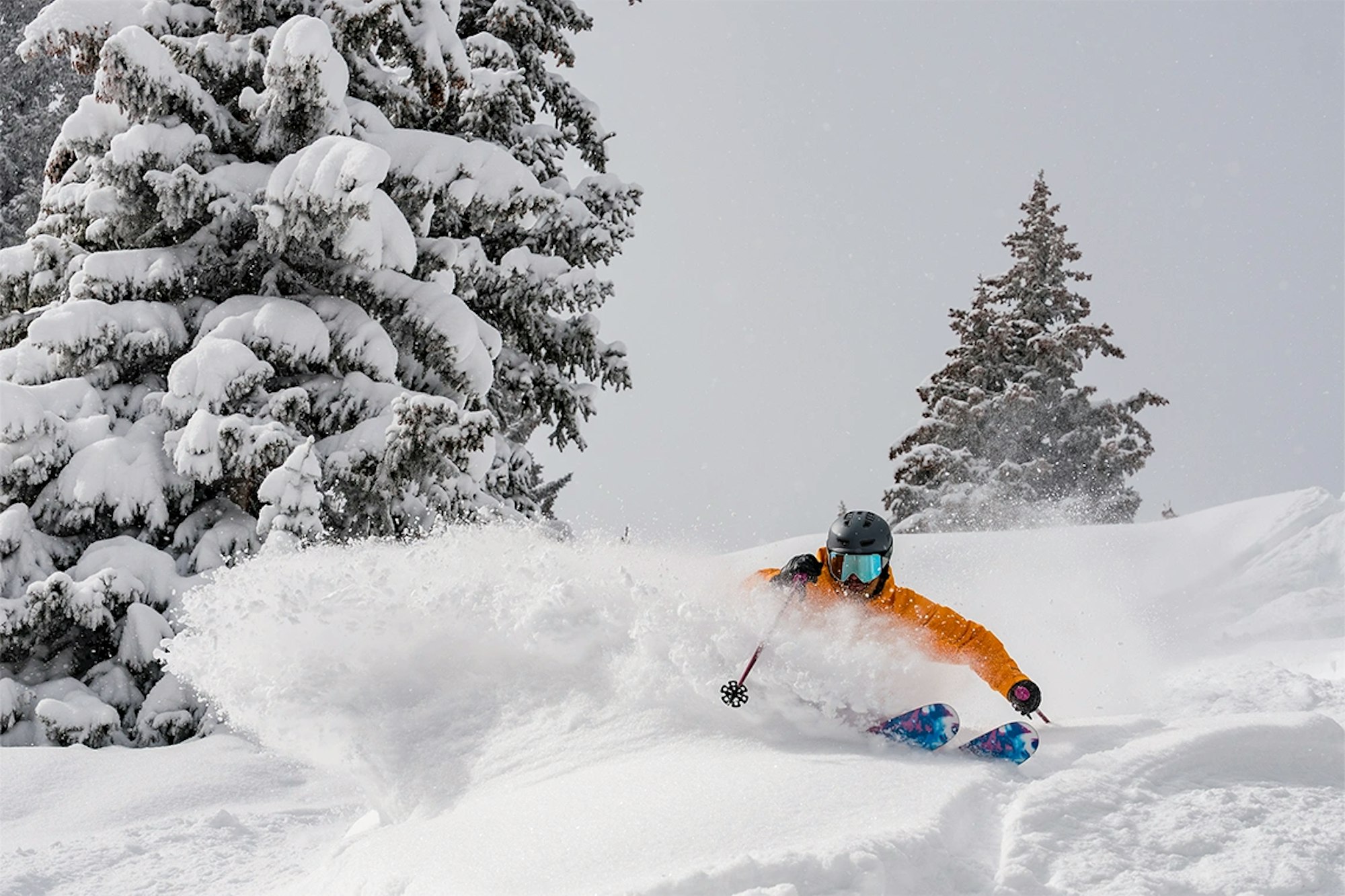
Featured Image: Gabe Rovick
Is it too early to start thinking about the next pow day? We agree with you, hell no it’s not! As we sit in the hot summer sun, we can’t help but think about winter 2025/26 here in North America. If that sounds relatable, it’s your lucky day. Experts at Open Snow and the National Oceanic and Atmospheric Administration (NOAA) delivered a sneak peek regarding the weather we can expect over the next 10 months.
With information covered in a recent update from Open Snow meteorologist Alan Smith, this breakdown dives into a way-too-early winter 2026 forecast, shedding light on if we’ll see a La Niña, El Niño or neutral winter, what those terms mean and what factors influence the outcomes. This is a precursor for Open Snow’s full winter forecast, which will be released next month in August, 2025.
We’ve included the full video from Open Snow below, as well as a few key takeaways and important points if you’re running short on time and just want to jump to the point.
It’s good to understand the specific terms before proceeding. NOAA states that, “El Niño and La Niña represent opposite extremes in the El Niño/Southern Oscillation (ENSO). The ENSO cycle refers to the coherent and sometimes very strong year-to-year variations in sea-surface temperatures, rainfall, surface air pressure, and atmospheric circulation that occur across the equatorial Pacific Ocean.”
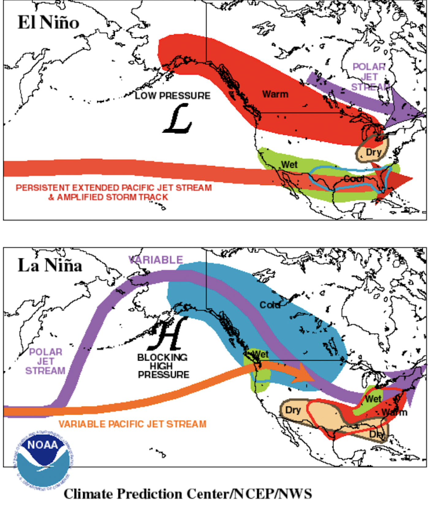

El Niño (top visual) is characterized by warmer than normal tropical Pacific ocean surface temperatures.
Typically lasts around 9-12 months and is more frequent, according to NOAA.
La Niña (bottom visual) is characterized by cooler than normal tropical Pacific ocean surface temperatures.
Typically lasts 1-3 years. According to NOAA, durations of either can vary greatly, even by a matter of years.
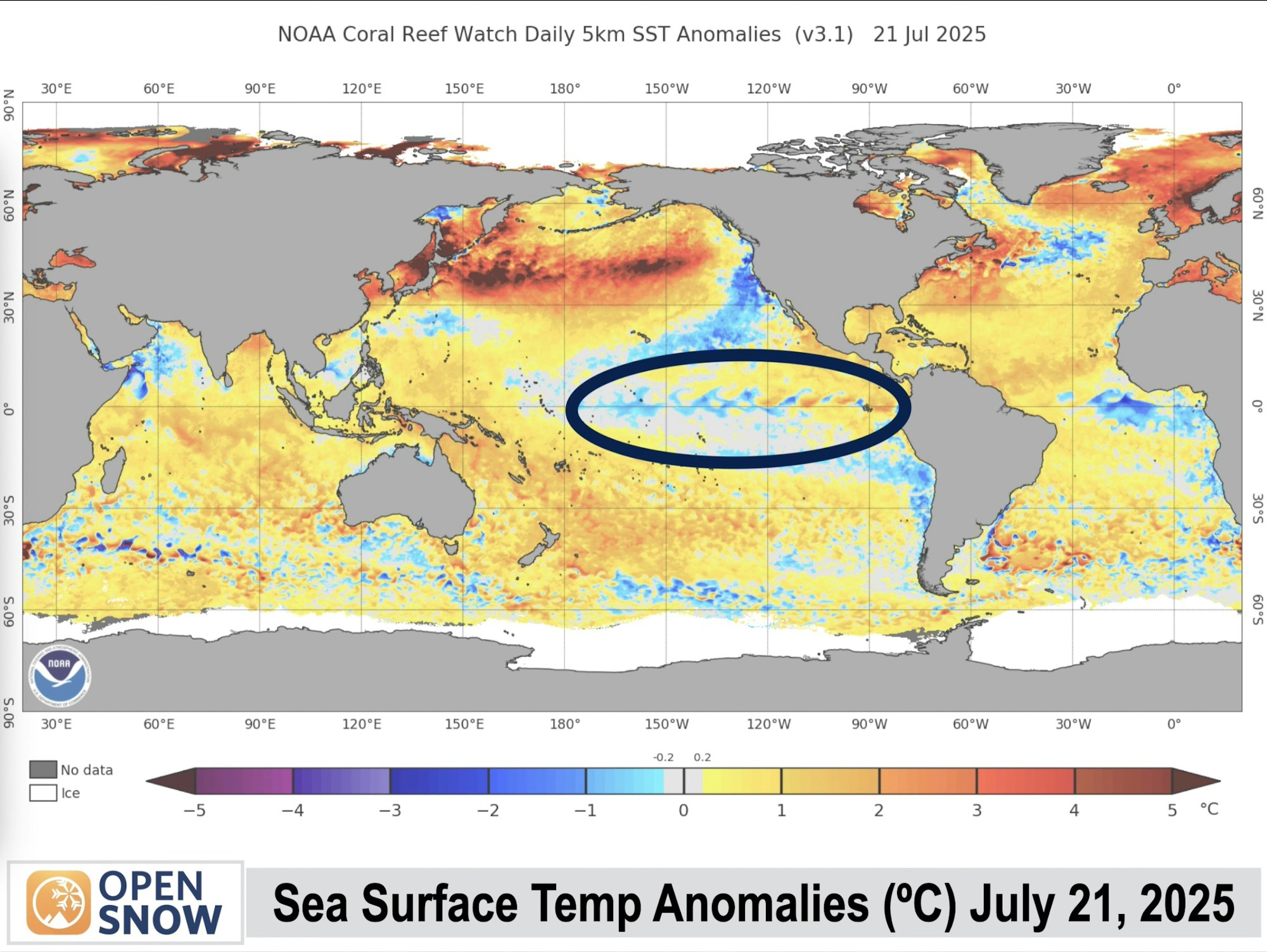
Currently in ENSO-Neutral
Next, let’s look at the factors Smith uses to determine his predictions. The El Niño Southern Oscillation (ENSO) cycle is key in determining an El Niño versus a La Niña system. It measures average sea surface temperatures off the western coast of Central and Southern America.
Currently, we are in an ENSO-neutral phase as seen in the diagram below. This means that temperatures have not strayed between +0.5°C and -0.5°C over five consecutive three-month periods. Averages of over +0.5°C are considered El Niño, while averages under -0.5°C are considered La Niña.
Neither El Niño or La Niña are present, but according to Smith and researchers at NOAA, that will likely change as we head into this winter.

ENSO-Neutral / Weak La Niña Winter Expected
It’s important to note that, as Smith points out in this chart, we have been in ENSO-neutral for over a year as of July 2025. Last winter only saw La Niña conditions present for two three-month periods, and not the required five three-month periods. So if you were expecting an El Niño winter because you thought last winter was La Niña, that is not the case.

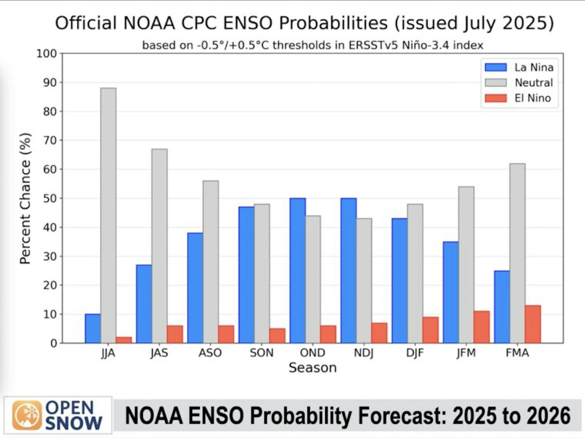
The latest probabilities from NOAA’s Climate Prediction Center (left) show a 50% chance of a La Niña winter emerging between October 2025 and January 2026.
There is less than a 10% chance of an El Niño cycle.
Based on this information, as well as projections from ENSO models published by the International Research Institute for Climate and Science, North Atlantic ocean temperatures and a wind pattern known as the Quasi-Biennial Oscillation, meteorologist Smith agrees with the NOAA predictions, though he states clearly that data is still being collected and Open Snow’s full opinions on winter predictions will be made available in their winter forecast published this August.
Where Will the Snow be This Winter?
The question we’ve all been waiting for. Smith gives us some insight, knowing that most current models all point to a weak La Niña or ENSO-neutral winter approaching.

Weak La Niña winters (above left) can historically bring sustained pockets of cold air in a low-pressure system, known as troughing, to the Rockies, Pacific Northwest, and upper New England.
ENSO-neutral winters (above right) can bring a similar troughing pattern to the Northern Rockies and New England, but a high-pressure ridge system tends to form off the west coast, bringing warmer temperatures and less moisture.
At this point, it’s hard to say who the winners or losers will be when it comes to snow totals this winter. However, it certainly seems that skiers in Wyoming, Montana and New England can keep their hopes high.
FREESKIER will put out a follow-up article when Open Snow releases their full 2025/26 winter forecast in August of 2025