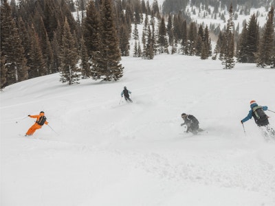
Featured Image: Gabe Rovick
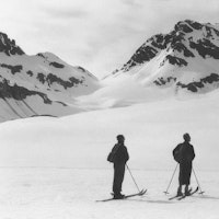
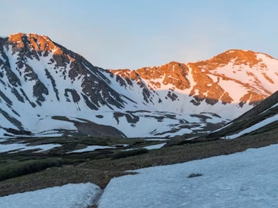
A La Niña cycle is looking more and more probable for winter 2025/26 in North America, according to the latest data published by the National Oceanic and Atmospheric Administration (NOAA). It's only fitting that Arapahoe Basin and Winter Park were blessed with hearty early-season snow flurries earlier today, fueling the stoke.
NOAA's Climate Prediction Center issued its September long-term outlook, forecasting through February 2026. The outlook saw a rise in La Niña emergence odds, with a high likelihood of winter 2025/26 starting with a La Niña cycle and transitioning into ENSO-Neutral as time goes on. Depending on which mountains you call home, this might be good news or bad news.
Let's dive into the specifics. What do these terms mean? How will this affect your region? Let's break it down.
It’s good to understand the specific terms before proceeding. NOAA states that, “El Niño and La Niña represent opposite extremes in the El Niño/Southern Oscillation (ENSO). The ENSO cycle refers to the coherent and sometimes very strong year-to-year variations in sea-surface temperatures, rainfall, surface air pressure, and atmospheric circulation that occur across the equatorial Pacific Ocean.”
Temperature averages are recorded in three-month overlapping periods. When five consecutive periods reach warmer (+0.5°C) or colder (-0.5°C) temperatures compared to the average, they are dubbed El Niño and La Niña, respectively. If temperatures do not stray that far from the average, the cycle is called ENSO Neutral.

Editor's Note: 0.5°C = apprx. 32.9°F
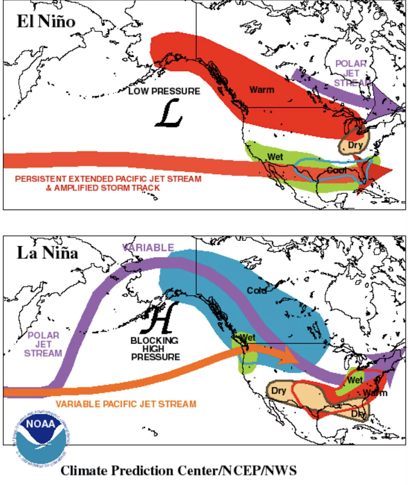
El Niño (top visual) is characterized by warmer than normal tropical Pacific ocean surface temperatures. Typically lasts around 9-12 months and is more frequent, according to NOAA.
La Niña (bottom visual) is characterized by cooler than normal tropical Pacific ocean surface temperatures. Typically lasts 1-3 years. According to NOAA, durations of either can vary greatly, even by a matter of years.
La Niña Watch Active
Currently, NOAA has issued a La Niña watch. This occurs when, "conditions are favorable for the development of El Niño or La Niña conditions within the next six months." This is different from a La Niña or El Niño Advisory, which is issued while conditions are present.
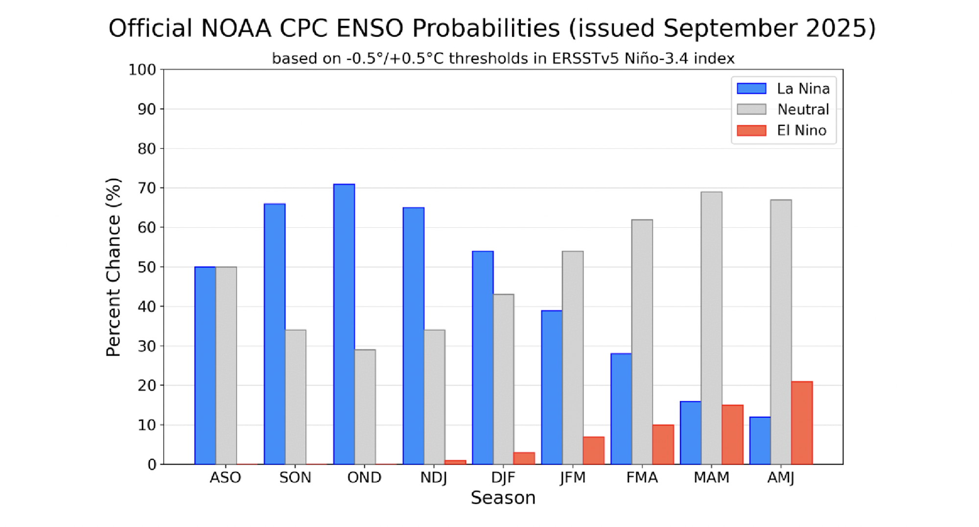
While we are currently not in a La Niña cycle, and ENSO-Neutral conditions prevailed during August 2025, NOAA has increased the odds of La Niña's emergence to 71% during October - December 2025. This is a large jump from the previous outlook, which favored a La Niña emergence in October by only 56%.
Several reputable weather forecast models are used to obtain this prediction. The team at NOAA derives a consensus based on averages from these models. "All available models from the North American Multi-Model Ensemble favor La Niña to emerge and persist through the winter," reads the recent Climate Prediction Center update.

As seen in this graph, La Niña (blue) is favored to persist through mid-winter, with ENSO-Neuteral conditions favored starting in February
Photo: Courtesy of NOAA
As seen in this graph, La Niña (blue) is favored to persist through mid-winter, with ENSO-Neuteral conditions favored starting in February
Photo: Courtesy of NOAA
The report continues, "Based on this guidance and recently observed trends across the surface and subsurface equatorial Pacific, the [NOAA] team also favors La Niña to develop. In summary, a transition from ENSO-neutral to La Niña is likely in the next couple of months, with a 71% chance of La Niña during October - December 2025. Thereafter, La Niña is favored but chances decrease to 54% in December 2025 - February 2026."
Find the Pow
This current forecast pairs similarly to predictions we've seen over the last few weeks. The previous outlook from OpenSnow and NOAA also suggested a La Niña winter, but bordering on ENSO-Neutral, with more emphasis on a weak emergence.
Considering the new data, it's fair to assume ENSO-Neutral snow patterns will be less likely. If you're hunting pow and trying to plan that perfect trip this winter, there are a few areas worth noting.
Regions with favorable snowfall during a weak La Niña include the Pacific Northwest, specifically stretching from Washington through British Columbia, the North-Central Rocky Mountains in Wyoming, northeastern Idaho and southwest Montana, the Great Lakes region and the upper Northeast.
Regions with unfavorable snowfall during a weak La Niña include the Sierra Nevada, much of California and Nevada, Utah and southern Colorado.
FREESKIER will publish a new post detailing NOAA's next Climate Prediction Center update on October 9, 2025.