Featured Image: Elise Sterck
Editor's Note: As of May 14, 2026, NOAA has increased the odds of El Niño's emergence to 82% by May-July, with a 96% chance by December.
We haven't even put our skis away, and people are already talking about next winter. But if they're talking, we might as well listen. The latest update on April 9 from NOAA's Climate Prediction Center confidently stated that we are transitioning from a La Niña system to El Niño by the end of June, 2026.
To be specific, there's a 61% chance that El Niño will emerge by June and persist through the end of 2026. A "strong" El Niño has a 50% chance of developing when Pacific Ocean temperatures rise more than 1.5 degrees Celsius above average.
Both El Niño and La Niña are different ends of the El Niño Southern Oscillation, also known as ENSO. The ENSO cycle is how scientists track and record ocean surface temperatures in the Pacific, using said temperatures to forecast weather around the world for the coming months. Just a few degrees can make a huge difference, with El Niño denoting consistent warming phases (+0.5°C from average) and La Niña denoting consistent cooling phases (-0.5°C from average).
You've likely heard these terms before, as for decades, skiers have obsessed over La Niña and shaken clenched fists of rage at the mention of El Niño. Yes, "Attack of La Niña" is one of our all-time favorite movies here at FREESKIER, but there is a broad misconception that La Niña means pow for all, and El Niño means drought. As is always the case, the truth is more nuanced, and a super El Niño might not mean what you think for your local mountains next winter.
Both patterns tend to bring moisture to different areas of North America. El Niño usually favors the Central Rocky Mountains and peaks in the Southwest (think Utah, Southern Colorado, Northern New Mexico), while La Niña winters bring lots of precipitation to the Northwest and Northeast corners of the continent (British Columbia, PNW, Vermont; we don't have to elaborate, you know your geography).
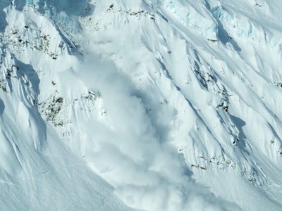
For the last year and a change, we've been oscillating between ENSO-neutral and La Niña. You may have noticed that British Columbia has had, by and large, a sublime winter, Vermont has had back-to-back good years, and Colorado and Utah have yet to sniff their strong totals from a few seasons back. That's no coincidence.
There are obviously exceptions to these theories. The Pacific Northwest had a mild winter in the United States, but not for lack of moisture. Washington received ample rain, enough to flood parts of the state, but they were missing the cold temperatures. The point is that these trends carry weight. So when NOAA calls for a super El Niño, what can you expect?
A super El Niño would be the term given to a "very strong" El Niño cycle, in which Pacific Ocean temperatures rise by more than 2 degrees Celsius above average. There is currently a 25% chance of this occurring, which is the highest chance in years, as the cycle is usually seen once every decade.
For skiers in the Pacific Northwest and Northern Rockies, this would likely bring around minimal powder days in 2027, as El Niño tends to shift the Jet Stream over the Southern United States.
This could be favorable for skiers in Nevada, Utah, Colorado, New Mexico, and Arizona. Colorado State University climatology professor Russ Schumacher told The Colorado Sun that residents of the Centennial State should bet on El Niño.
Though he cautioned against optimism, stating that even if the weather pattern brings heavy rain later this summer and snow in the winter, it wouldn't rescue the state from its sustained drought. "Monsoon rains just aren’t nearly enough to fill up reservoirs or even bring them back up from really low levels,” said Schumacher.
The bottom line is that much of the American West is currently facing historically low water levels. Shortages will be felt by all of us when the time comes, and short-term changes won't be enough to correct course. Let's hope La Niña brings moisture where it's needed, and make adjustments as individuals whenever we can, so that we might see another pow turn yet.
Stay tuned as FREESKIER continues to monitor NOAA's Climate Prediction Center