Featured Image: Gabe Rovick, OpenSnow
East Coasters, the time is now! What has already been a generous winter for snow-inclined individuals out East is about to get even better, as a large storm is descending on the Atlantic seaboard of North America. Cold air and ample precipitation are expected to hit hard from Arkansas through Virginia, and further up into New Hampshire and Maine.
Our friends at OpenSnow have been tracking this far-reaching weather event with excitement. "This particular winter storm, forecast to begin this weekend [1/25/26], is on track to deliver substantial snowfall to every ski area on the East Coast," OpenSnow forecaster Zach Butler said in a recent update on January 21.
Butler continued, "Some resorts in the southern Appalachians could see two feet of snow. Resorts in the Northeast — particularly in New York — could also receive significant lake-effect snow, building on their already strong base depths and pushing some well above their average annual snowfall, which is in stark contrast to what is happening in the West."

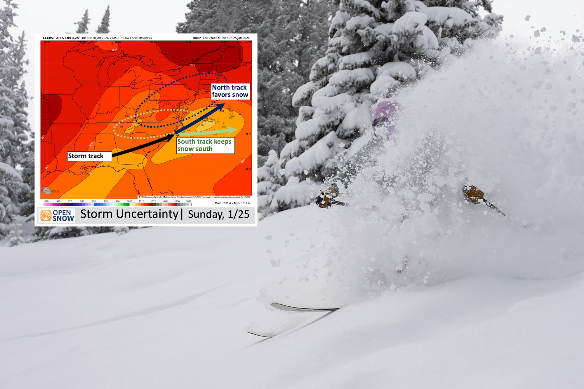
OpenSnow description: The “L’s” on the map show the potential locations of a storm system, and the black circle shows the area most favorable for storm development.
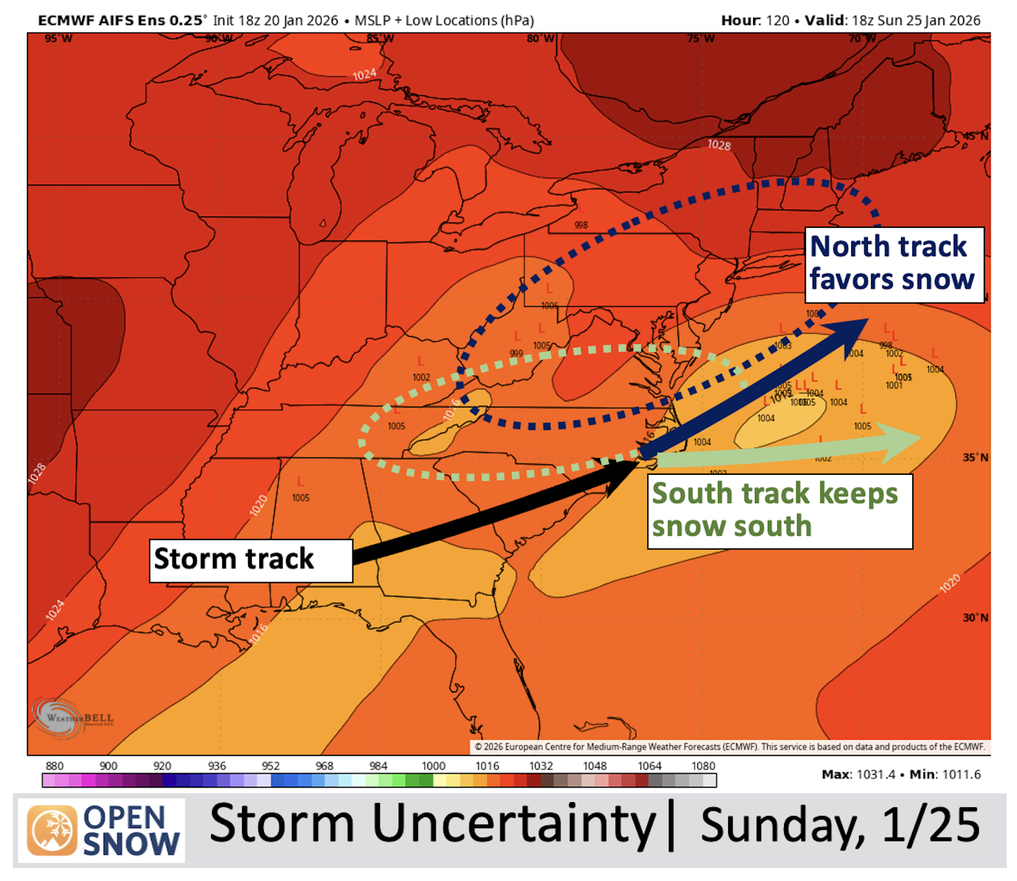
OpenSnow description: The “L’s” on the map show the potential locations of a storm system, and the black circle shows the area most favorable for storm development.
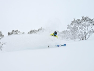
Arctic air carrying cold temperatures has already flooded the continent, though western skiers will have to be a bit more patient. The cold weather isn't delivering snow to them, with the exception of a brief but intense snowstorm expected this weekend at Southcentral and Southwest ski areas like Aspen, Crested Butte, Telluride and Taos. But by and large, this is an East Coast weather event.
Areas in Pennsylvania and New York have already seen several inches in snow over the last 48 hours. Meteorologists tend to agree that after a slight warming trend at the end of the week, temps willd drop again and the snow will begin to fly.
Perhaps the most notable part about this storm cycle is that it will cruise along the Mason-Dixie line, bringing with it a trecherous mix of snow and ice as far inland as Texas. As it moves along the coast heading northeast, the biggest winners at the moment seem to be West Virginia and New York.
Editor's Note: You might know it, but the ski scene is robust in ole West Virginia. Check out this iconic article from FREESKIER Volume 25 Issue 02.

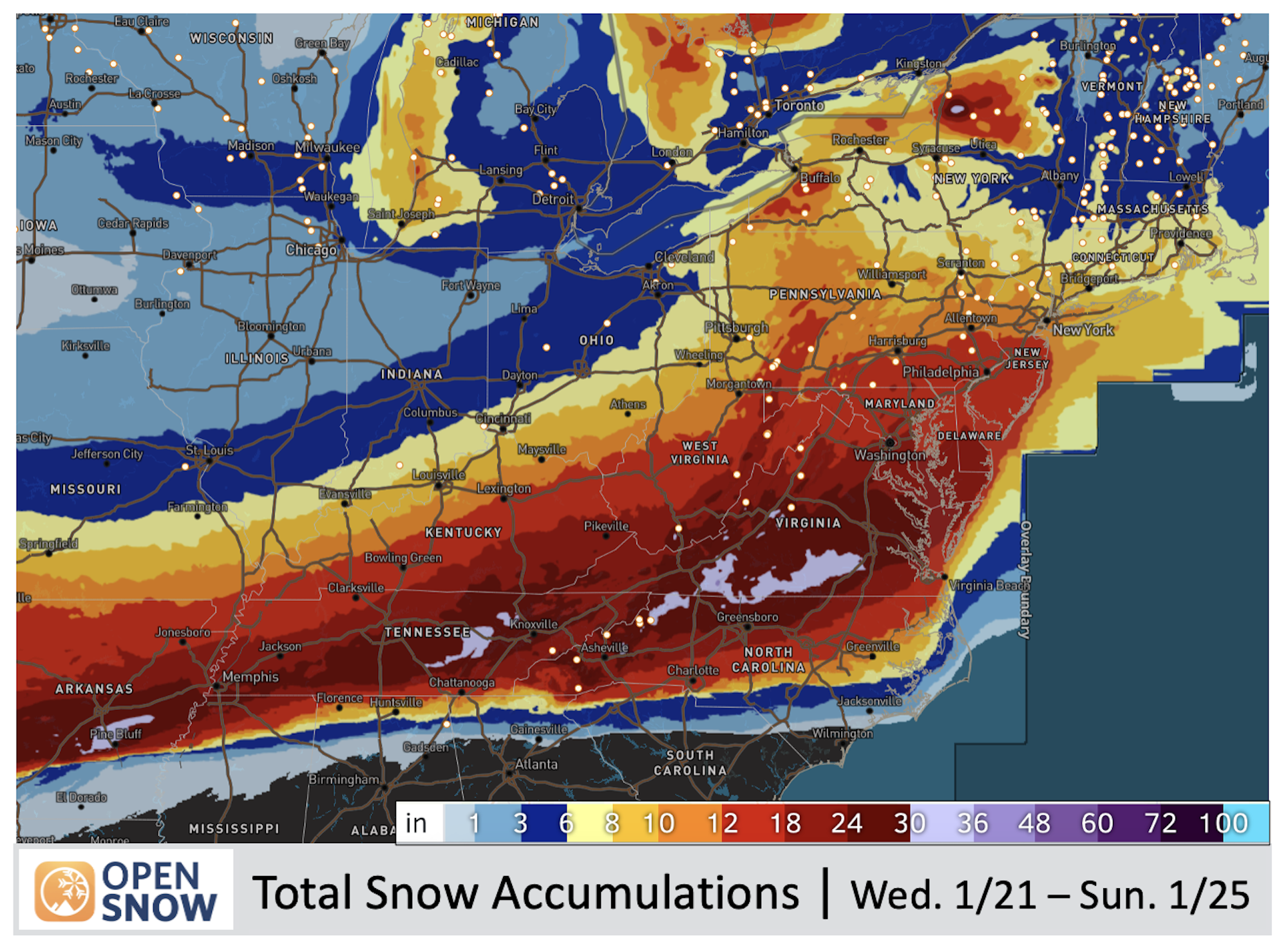
The bulk of the storm is expected to hit on Sunday, 1/25/26. Timberline Resort and Canaan Valley, West Virginia, currently lead OpenSnow's East Coast forecast predictions for resorts, with 25 inches of snow expected from Sunday through Monday. This will be slightly more wet snow than compared to the precipitation farther north. In Pennsylvania, Liberty Mountain, a resort that hasn't seen snow in the last 20 days, is anticipating 23 inches between Sunday and Monday.
In New York, lake effect snow is going to pile up. Kissing Bridge Resort has seen 37 inches over the last 15 days, and the good luck will continue as 15 inches or more is likely to fall in the latter half of this weekend. Slightly smaller totals can be expected in New Hampshire and Maine, with Cannon Mountain, NH, expecting 10 inches of snow through the weekend and Sunday River, ME, anticipating nine inches by Monday evening.
While the snow is supposed to be quick and fierce, the cold air will linger, which is great news for snowmaking operations along the Atlantic. Anyway you slice it, this January refresh will be welcomed with arms wide open by Northeast rippers. For the FREESKIER faithful in Virginia and farther south, be careful of extreme ice and sleet. But if you're out east, get to your local hill (safely) and enjoy the fresh turns! When you're done, send some of Ullr's blessings out west.
This weekend also marks the 25th anniversary of X Games Aspen. Click below for our full guide to the event, from competition details to our top riders to watch and more.