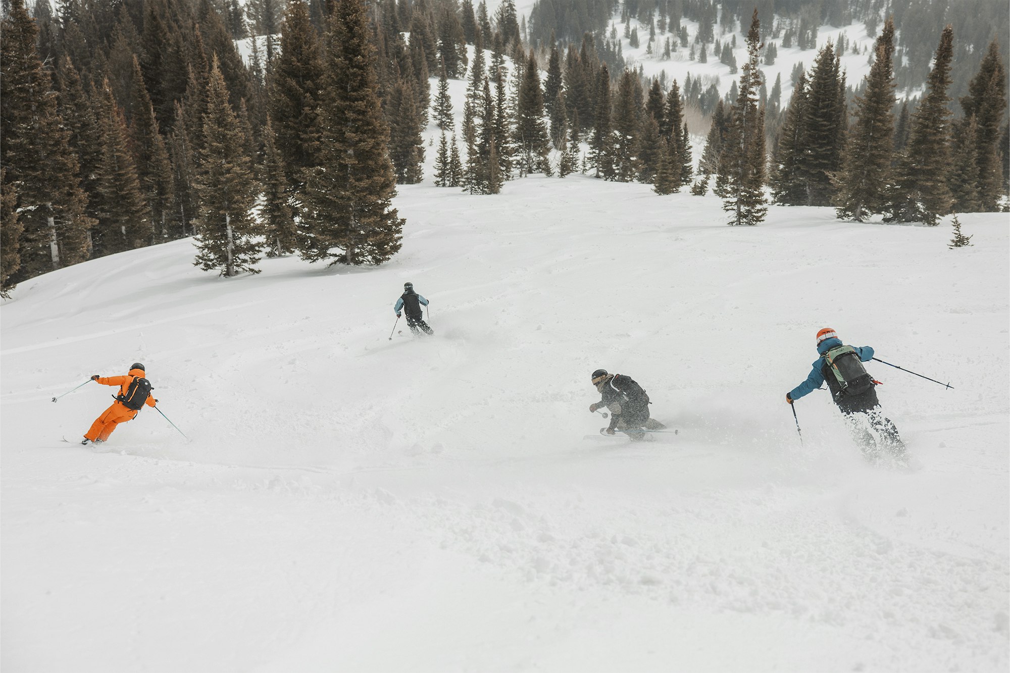
Featured Image: Elise Sterck
The impending winter's forecast is rarely seen as a surefire bet, but the winter of 2026/27 is shaping up to be a bit different. Experts from around the globe are unified in their call for a major El Niño event.
Just the other week, the National Oceanic and Atmospheric Administration (NOAA) announced that El Niño is in effect, based on current sea surface temperatures (SST). But the strength of the impending system is what has meteorologists looking twice. Some experts are suggesting this could be the strongest El Niño event on record. OpenSnow meteorologist Alan Smith is one of those experts.
In a recent report, Smith uses both sea surface temperatures and their rate of warming as metrics to compare the current weather system with past events. His results leave one major question on the table but offer grand insight into the months ahead.
It's important to first understand El Niño and La Niña weather patterns. These two terms represent warm and cold average sea surface temperatures, with El Niño being +0.5°C of the average for three months straight, and La Niña being -0.5°C of the average for three months straight.

NOAA sea surface temperatures (SST) as of June 15, 2026
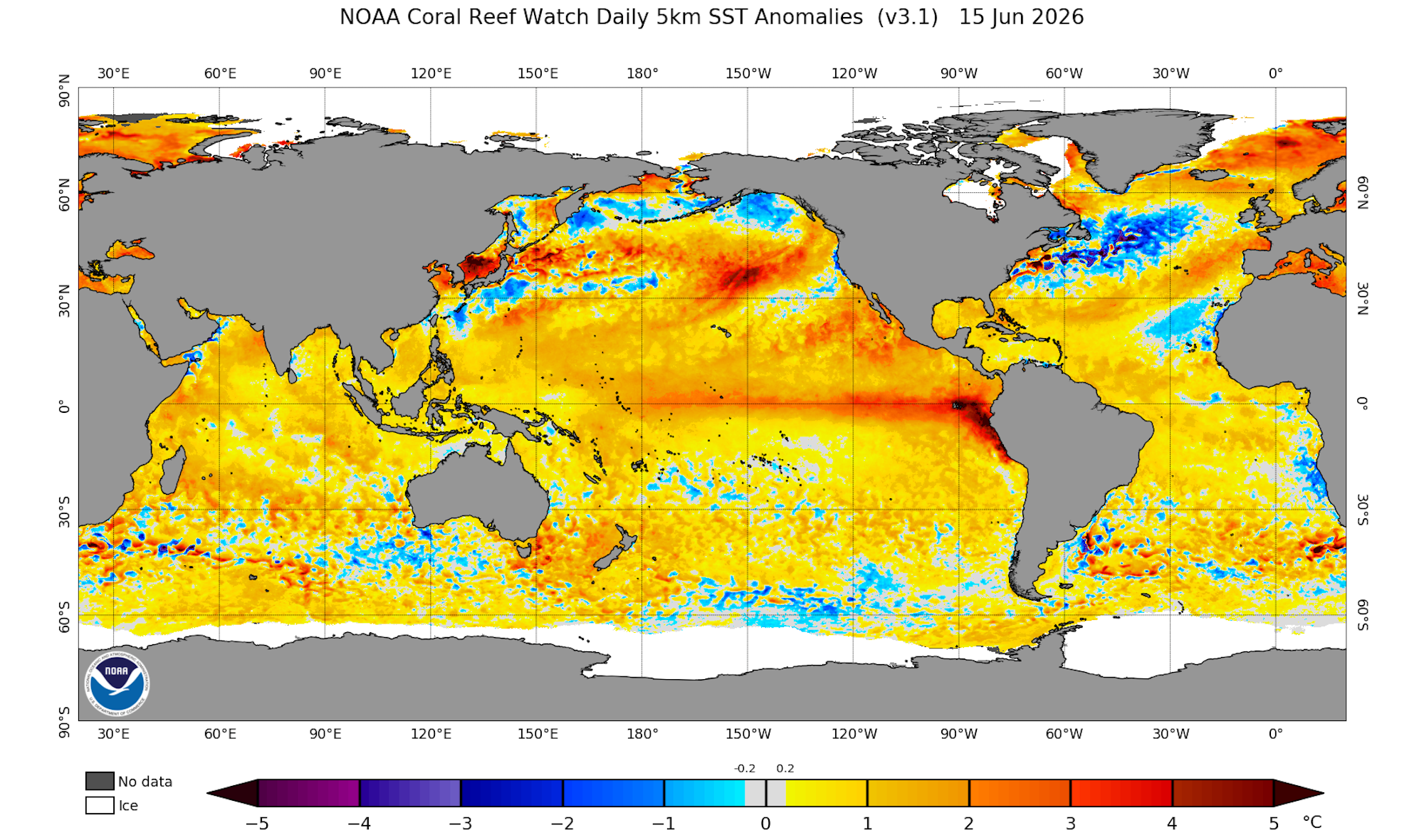
NOAA sea surface temperatures (SST) as of June 15, 2026
While we have officially entered El Niño, the remaining questions are how long it will last and how strong the system will be. El Niño strength is determined by:
Neutral: Anomaly of < 0.5°C
Weak El Niño: Anomaly of 0.5° to 1.0°C
Moderate El Niño: Anomaly of 1.0° to 1.5°C
Strong El Niño: Anomaly of 1.5° to 2.0°C
Super El Niño: Anomaly > 2.0°C
The latest SST anomalies report from NOAA (pictured above) shows very high temperatures off the coast of South America, a stark contrast to when La Niña conditions persisted just a few months ago, in March of 2026. This is important because the rate of warming can influence the type of El Niño we experience.
"Compared to past emerging El Niños, the sea surface temperature profile is similar to where we were in June 2023," Smith notes. "However, the rate of warming is faster this year, as we did not transition out of a La Niña in the Central Pacific until April of 2026, whereas it happened in March of 2023.
He continues, "Sea surface temperatures in the [central Pacific] region are warming at a faster rate this year compared to the spring/summer of the previous two super El Niño years of 2015 and 1997." The cause of this rapid warming rate is heavily debated, but the important point here is that we're seeing nearly unprecedented trends in SST increases, which, based on past data, have led Smith and colleagues to conclude we're due for a Strong or Super El Niño this winter.


NOAA El Niño emergance probabilities (left) and strength probabilities (right)
Based on both the rate of warming and the temperatures themselves, NOAA predicts that El Niño's chances of persisting through March 2027 are nearly 100%, as shown in the graph above (left). Odds of a Very Strong El Niño emerging by December hover around 60%.
Smith also adds that, "The individual members of the June 2026 European Seasonal Model (multiple simulations with slightly different initial conditions) project SST anomalies to peak between 3.0° and 4.0°C by late fall 2026. This would put this El Niño event in the conversation of the strongest on record, even if the lower-end projections of this range were to verify."
While we could stew over the implications for global weather systems, you're here to learn about skiing, so we'll focus on how this event would affect skiers across North America. El Niño winters usually bring above-average temperatures to the West Coast, the southern tier of states, and the East Coast. For East Coast skiers, who are already coming off a banner winter, this is good news.
For interior resorts, which constitute many of our favorite mountains from Utah to Colorado and up through Montana, it's a more difficult bet. Smith says that to predict accurately in these areas, meteorologists will need "a closer evaluation in terms of the strength, structure, and timing of El Niño phases, along with other oceanic-atmospheric signals such as North Pacific sea surface temperatures, Atlantic sea surface temperatures, and QBO (Quasi-biennial Oscillation, which is a measure of upper atmospheric trade winds in the tropics)."
And IF this system turns out to be truly record-setting, an outcome Smith claims is still up in the air but a very real possibility, the results will vary even more. The disparity between areas with precipitation and areas caught in drought could be dramatic. Smith points to the Super El Niño of 1887/88 to back up this claim, in which global famine and weather anomalies soared worldwide.
Are we likely to see fallout similar to that of over a century ago? No. Food systems are far more robust. But that's not to say there couldn't be consequences in other forms. For more accurate information, we'll have to wait. But one thing is certain: El Niño has arrived, and it's not going anywhere anytime soon.