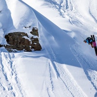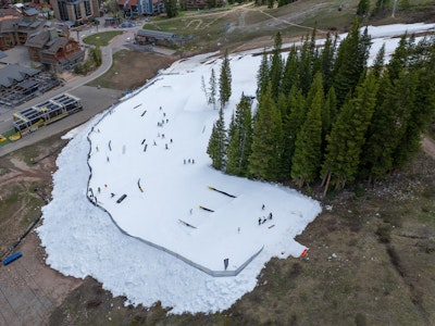
Featured Image: Gabe Rovick

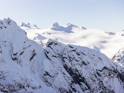
There's no beating around the bush at this point, avalanche conditions are straight up scary right now across the Western United States. California and Utah have received the brunt of the avalanche-related bad news this month and the weather has made huge swings from a multi-week dry spell, to storms dropping feet of snow in a matter of hours, to wicked amounts of rain and wind to fudge it all up for us. The desperation for powder skiing has reached its peak, we're all feeling the pent-up pressure to ski good snow, stack some clips and feast on that powder-fueled dopamine drip.
Now is the time to check in on ourselves and our friends, tell them you love them and take advantage of sunny days at the resort until a proper spring freeze-thaw cycle starts stabilizing our snowpacks. Now is the time to practice patience. Now is the time to recognize how human heuristics come into play in backcountry recreation. As of Friday, February 27, we're looking at considerable and high avalanche danger from Washington and California on the coast, to Idaho, Wyoming, Utah and Colorado.
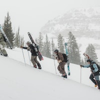
Below you will find a brief assessment of the current snowpacks across the Mountain West, according to each region’s avalanche center. From Washington and Oregon to California, Idaho, Montana, Wyoming, Utah and Colorado, we are here to help disseminate the information provided by real professionals. Moral of the story right now: Our safest option is to stay off of and away from slopes steeper than 30 degrees, and the shallow riding conditions don't really justify the avalanche risk.
California
The biggest threat in the Central Sierra Nevada forecast zone today is wet, loose avalanches. After receiving multiple feet of snow last week, the weather took a warmer turn and dropped copious amounts of rain and much of the forecast region saw above-freezing temperatures last night up to 7,000 feet. The potential for stepping down deeper into the snowpack has reduced significantly but a superficial refreeze overnight won't do much to keep the snowpack from melting more today.
Colorado
While California is starting to see some relief from avalanche danger, Colorado is still very much in the danger zone with the likely possibility of triggering a slide that steps down to the buried weak layers two to three feet deep. All north and east-facing aspects will be dangerous today, but heavily wind-drifted slopes will be particularly deadly. It's in your best interest to stay off of out and out from under slopes steeper than 30 degrees this weekend.
Idaho
The entire state of Idaho is surrounded by considerable avalanche danger today. Between Tuesday night and Wednesday of this week, the Sawtooth Avalanche Center reported over 100 natural avalanches in the central Idaho forecast zone and the likelihood of stepping down to the persistent weak layer is very likely on wind-drifted slopes as well as more protected steep slopes. Unfortunately, the best way to avoid trouble is to give avalanche terrain a wide berth. This includes gentler terrain below and above steep slopes.
Montana
Gallatin National Forest Avalanche Center
Avalanches remain easy to trigger throughout the Gallatin's forecast zones, with the danger rated considerable across the state. Wind slabs are the number one problem in Montana, with the likelihood of stepping down to the persistent weak layer being of main concern. This is particularly true in the areas near Island Park, West Yellowstone and Cooke City that have gotten more snowfall recently. The Gallatin Forecast Center says in their forecast for today, "There have been too many avalanches in recent days to try and list them all." Let that be all the warning you need to stay off of and out from under avalanche terrain.
Oregon
Central Oregon Avalanche Center
The Central Cascades of Oregon are seeing moderate avalanche ratings across the forecast zone today. While a persistent weak layer continues to be a problem in the interior states, Oregon's main avalanche hazard today and going into this weekend is wet, loose avalanches, especially on slopes with extended sun exposure later in the day. Triggering avalanches in old wind drifts at the mid and upper elevations is unlikely but still something to consider before entering steep and committing terrain.
Utah
Utah is still very much not in the clear when it comes to avalanche danger. The northern Logan forecast zone has a rating of moderate, while the Uintas are rated as high today and the rest of the Utah zones are nestled in the middle with considerable avalanche danger. The Logan forecast is moderate mostly because rain fell up to 8,500 feet, melting away much of the snowpack below 7,000 feet and saturating the snow and creating a thick, hard crust on top of the snowpack. The snowpack is incredibly complex in the Uintas right now, with aspects NW-N-NE-E above treeline being the most concerning areas. Avalanche conditions remain dangerous in the Ogden, Salt Lake, Provo and Skyline zones.
Washington
While it's not common to see a persistent weak layer in the coastal state of Washington, that's exactly what we're seeing throughout the state's snowpack. As of today, Friday, February 27, avalanche danger is high in the East Slopes North forecast zone and considerable across the rest of the forecast areas in the state. High winds have loaded on top of this weak layer, making it extremely likely to trigger a large enough avalanche that could kill you. The most dangerous areas will be above 5,000 feet, where the wind is depositing snow and forming stiff slabs.
Wyoming
Bridger-Teton Avalanche Center
While it's nice to see low avalanche danger in the lower elevations of Wyoming (below 7,500 feet) that's because the recent rain has melted much of that low-elevation snowpack. Weak snow that formed in January sits beneath 2-3 feet of more recent snowfall, most of which fell rapidly 2-3 days ago, and it remains possible to trigger very large avalanches with slab depths reaching 4 feet in wind loaded terrain. The layer has been most reactive on the west side and the southern portion of the Tetons but has produced avalanches most everywhere in all Bridger Teton's forecast zones.